When Does It Snow in Japan? 2026-27 Forecast and City Dates
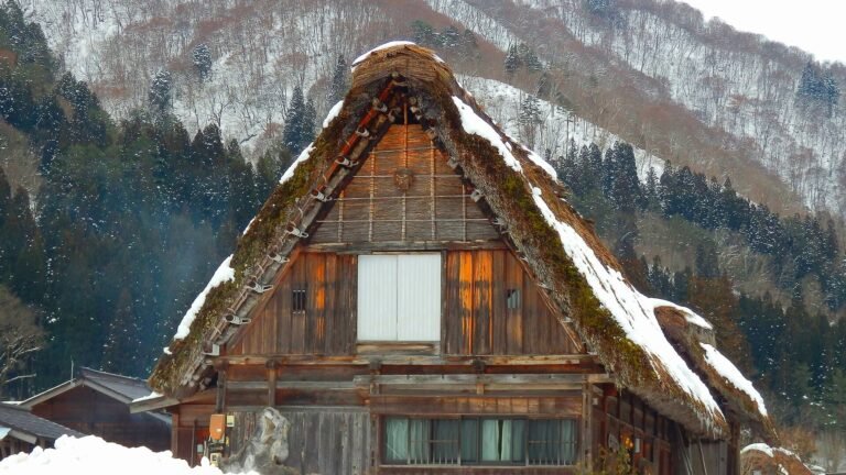
So the answer to when it snows in Japan depends on where you stand. Japan runs a long way from north to south. The Sea of Japan coast catches far more snow than the Pacific side, where Tokyo and Osaka sit. The dates in this guide are the Japan Meteorological Agency (JMA) normals, the averages for 1991-2020 at each city’s weather station. For this winter, we use JMA’s own outlooks and nothing else.
First snow dates by city in Japan
Hokkaido gets its first snow in late October and the Sea of Japan side of Honshu in November. Kyoto, Nagoya and Osaka follow in December, and Tokyo in January.
We checked every date below against the JMA normals on 16 October 2026. JMA counts the first snow as the first day of the season it records snow at the station, so a few flakes count. Snow that stays on the ground comes later, and the last snow of the season can fall well into spring.
The table below puts ten cities in order of their first snow, with the last snow and the total snowfall for an average year. Sapporo’s season runs from 28 October to 21 April. Tokyo’s runs only from 3 January to 9 March.
| City | First snow | Last snow | Snowfall a year (cm) |
|---|---|---|---|
| Sapporo | 28 October | 21 April | 479 |
| Hakodate | 1 November | 16 April | 306 |
| Aomori | 8 November | 15 April | 567 |
| Nagano | 18 November | 8 April | 163 |
| Niigata | 23 November | 6 April | 139 |
| Kanazawa | 24 November | 7 April | 157 |
| Kyoto | 11 December | 23 March | 15 |
| Nagoya | 18 December | 12 March | — |
| Osaka | 26 December | 8 March | 1 |
| Tokyo | 3 January | 9 March | 8 |
Sapporo’s first snow comes 67 days before Tokyo’s, and Kyoto’s comes 23 days before Tokyo’s. Aomori, at the northern tip of Honshu, has the heaviest snowfall in the table at 567 cm a year. Kyoto gets 15 cm, Tokyo 8 cm and Osaka about 1 cm.
Inside Hokkaido the season starts even earlier. The JMA Sapporo Regional HQ first snow normals for Hokkaido give 19 October for both Wakkanai, at the northern tip, and Asahikawa. Kutchan, the town near Niseko, follows on 20 October. Obihiro and Hakodate wait until 1 November. The mountain peaks turn white first. Mount Asahidake gets its first snow cap on 25 September, and Mount Teine above Sapporo on 18 October.
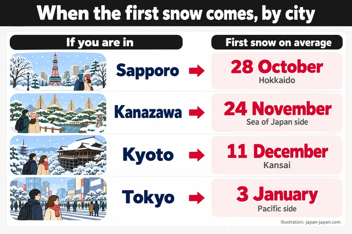
The quick lookup above shows four cities you are likely to visit. Sapporo comes first on 28 October, then Kanazawa on 24 November, Kyoto on 11 December and Tokyo on 3 January. For weather, events and clothes month by month in each city, open our Japan by month guide.
Does it snow in Tokyo?
Yes, but it does not always settle: Tokyo’s first snow comes on 3 January on average. Snow cover of 1 cm or more appeared in only 19 of the 30 winters from 1991 to 2020.
That is about 2 winters in 3. The JMA normals first and last snow days Tokyo page lists 23 January as the first day with 1 cm on the ground. The last such day is 10 February. The last snow of the season falls on 9 March on average.
Snow falls more often than it settles. By JMA’s snow-day count, Tokyo averages 0.6 days in December, 2.8 days in January and 3.5 days in February, for 8.5 days a year. The JMA monthly normals Tokyo temperature and snow days table shows those counts month by month.
The amounts stay small. The JMA monthly snow normals Tokyo put the total at about 8 cm a year. Tokyo sees 1 cm or more of new snow on 1.9 days a year, and 5 cm or more on 0.5 days. The deepest snow in an average January or February is 3 cm.
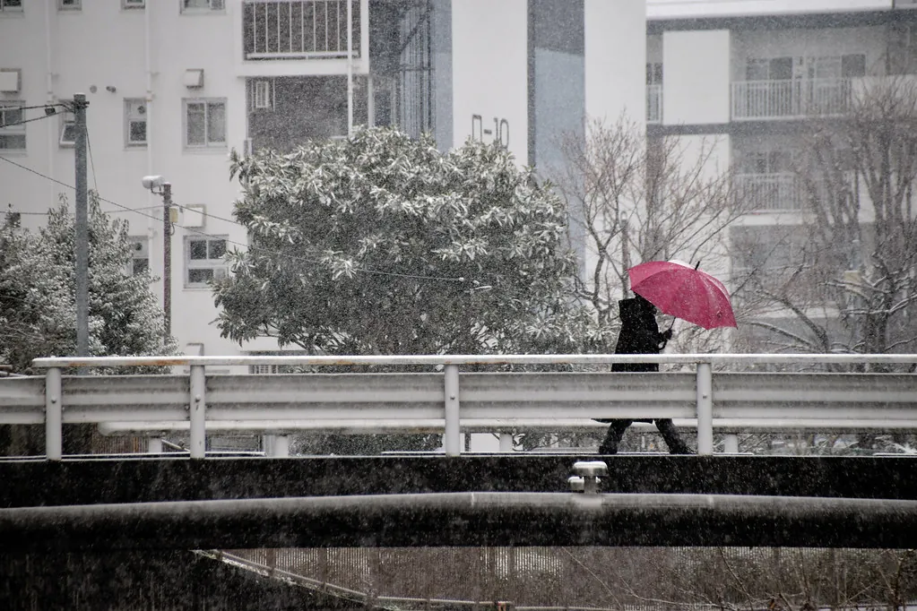
A Tokyo street under snow, like the one in the photo above, is a rare sight in a normal year. The date of the first snow also swings a lot. The JMA Tokyo Regional HQ first snow notice December 2024 lists the earliest first snow on record: 17 November 1900. The latest came on 16 March 2007.
Recent winters show the same spread:
- 2021-22: First snow on 26 December 2021.
- 2022-23: First snow on 24 January 2023.
- 2024-25: First snow on 19 December 2024, 15 days earlier than normal and 25 days earlier than the previous winter’s 13 January.
Pack for cold rather than for snow. Tokyo’s mean temperature is 5.4°C in January with a daily low of 1.2°C, and 6.1°C in February with a low of 2.1°C. Our Tokyo in January and Tokyo in February pages list the events and what to wear.
Does it snow in Kyoto?
Yes, a little each winter: Kyoto’s first snow comes on 11 December on average. Snow cover of 1 cm or more first appears on 12 January and last appears on 8 February.
The JMA normals first and last snow days Kyoto page puts the last snow of the season on 23 March. Kyoto sees snow earlier and more often than Tokyo or Osaka, though the totals are still small by northern standards.
The JMA monthly snow normals Kyoto give 1.6 days with 1 cm or more of new snow in January and 2.2 days in February. The yearly figure is 4.9 days. Total snowfall is about 15 cm a year. The deepest snow averages 3 cm in January and 4 cm in February.
The table below compares the three big cities that most visitors see in winter, month by month.
| City and month | Snowfall (cm) | Days with 1 cm+ of new snow | Deepest snow (cm) |
|---|---|---|---|
| Tokyo, January | 4 | 0.7 | 3 |
| Tokyo, February | 4 | 0.8 | 3 |
| Kyoto, January | 5 | 1.6 | 3 |
| Kyoto, February | 7 | 2.2 | 4 |
| Osaka, January | 0 | — | — |
| Osaka, February | 1 | — | — |
The JMA monthly normals Kyoto temperature and snowfall show why snow rarely lasts. January averages 4.8°C, with a high of 9.1°C and a low of 1.5°C. February averages 5.4°C, with a high of 10.0°C and a low of 1.6°C.
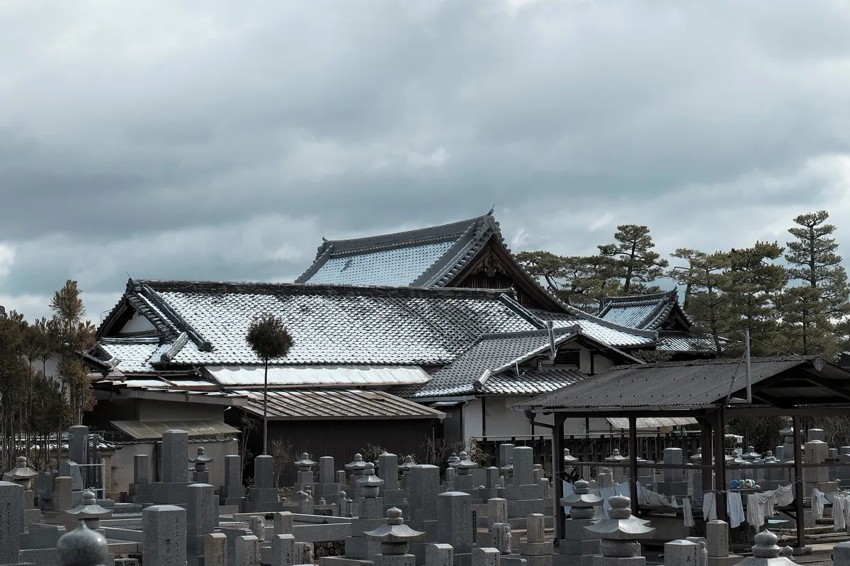
A temple roof under fresh snow, as in the photo above, is the picture many visitors hope for. See Kyoto in January and Kyoto in February for temples, events and clothing.
Does it snow in Osaka?
Hardly ever enough to settle: Osaka’s first snow comes on 26 December on average. Snow cover of 1 cm or more appeared in only 9 of the 30 years from 1991 to 2020.
That is about 1 winter in 3. The JMA normals first and last snow days Osaka page puts the first day with 1 cm on the ground at 29 January. The last snow of the season falls on 8 March. Osaka’s first snow comes 8 days before Tokyo’s.
Flakes are not unusual. The JMA monthly normals Osaka temperature and snow days give 4.7 snow days in January by JMA’s snow-day count, with 0 cm of total snowfall. February has 5.5 snow days and about 1 cm. In other words, snow falls but rarely builds up.
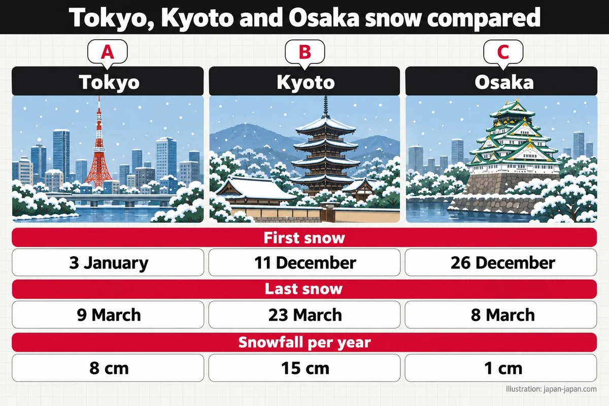
The comparison above lines up Tokyo, Kyoto and Osaka on the same three rows: first snow, last snow and snowfall per year. Osaka has the smallest total. The JMA monthly snow normals Osaka give only 0.4 days a year with 1 cm or more of new snow. Kyoto has 4.9 such days.
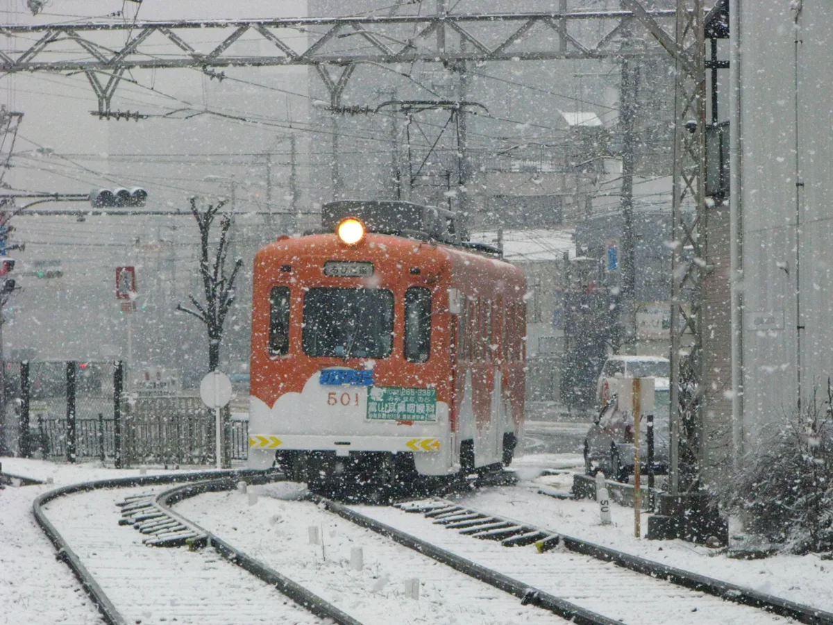
Snow like this, on a tram line in Osaka, is a rare sight. Osaka is mild for a winter city: January averages 6.2°C with a low of 3.0°C, and February 6.6°C with a low of 3.2°C. If snow is the point of your trip, plan a day in Kyoto or on the Sea of Japan side. Our Osaka in January and Osaka in February pages cover the rest of the weather.
Sapporo snow and the snowiest cities
Sapporo gets 479 cm of snowfall a year, and Aomori tops this guide at 567 cm.
Sapporo’s 479 cm is about 60 times Tokyo’s 8 cm. The JMA monthly normals Sapporo temperature and snowfall break it down by month:
- December: 113 cm of snowfall, mean temperature -0.9°C.
- January: 137 cm of snowfall, deepest snow 76 cm, mean temperature -3.2°C.
- February: 116 cm of snowfall, deepest snow 95 cm, mean temperature -2.7°C.
- Whole year: deepest snow 97 cm and 134.5 snow days by JMA’s count.
The JMA normals first and last snow days Sapporo page shows how the snow builds. Snow first covers the ground on 9 November, and 1 cm or more on 12 November. Lasting snow cover begins around 3 to 6 December and ends around 2 to 3 April. Between those dates, the city stays white. Our Sapporo in January and Sapporo in February pages have the daily highs and lows. The Sapporo Snow Festival 2027 guide covers the city’s biggest winter event.
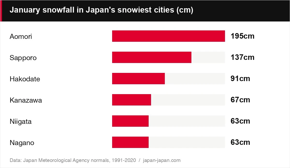
| Item | Value |
|---|---|
| Aomori | 195 cm |
| Sapporo | 137 cm |
| Hakodate | 91 cm |
| Kanazawa | 67 cm |
| Niigata | 63 cm |
| Nagano | 63 cm |
The chart above ranks January snowfall in six snowy cities. Aomori leads with 195 cm and a mean January temperature of -0.9°C, ahead of Sapporo at 137 cm. Hakodate gets 91 cm in January and 306 cm a year. Kanazawa gets 67 cm in January and 157 cm a year. Niigata and Nagano both get 63 cm in January, with 139 cm and 163 cm a year. Nagano averages -0.4°C in January, close to Aomori’s -0.9°C.
Each city has its own January page: Aomori in January, Kanazawa in January, Niigata in January and Nagano in January. Of the 10 places on our Hokkaido in January page, Kutchan has the deepest snow, at 155 cm on average.

Snow banks along a Sapporo street, like the ones in the photo above, last for months. For snow on the slopes, check the Japan ski report. For towns, onsen and festivals that look best under snow, see our places to visit in Japan in winter.
Japan snow forecast for winter 2026-27
As of its 18 September 2026 issue, the JMA cold-season outlook for winter 2026-27 expects below-normal snowfall on the Sea of Japan side of eastern and western Japan.
On JMA’s pages this report is called 寒候期予報 (kankōki yohō), the cold-season outlook. For northern Japan’s Sea of Japan side, it expects snowfall near or below normal. Temperatures should run high in eastern and western Japan and in Okinawa and Amami, and near or above normal in northern Japan. JMA’s western Japan snow forecast covers the Sea of Japan side of Kinki and the San’in coast, not northern Kyushu.
The outlook gives each region a probability for below-normal, near-normal and above-normal snowfall. The table below shows all four Sea of Japan regions.
| Region | Below normal | Near normal | Above normal |
|---|---|---|---|
| Northern Japan, Sea of Japan side | 40% | 40% | 20% |
| Eastern Japan, Sea of Japan side | 50% | 30% | 20% |
| Western Japan, Sea of Japan side | 50% | 30% | 20% |
| Kinki, Sea of Japan side | 50% | 30% | 20% |
Read the table as odds, not a promise. A below-normal winter has a 50% chance on the eastern, western and Kinki Sea of Japan side. That is 2.5 times the 20% chance of an above-normal winter. That 20% is still there, so a snowy winter remains possible.
For the Kanto-Koshin region around Tokyo, JMA puts temperature at 10% low, 30% near normal and 60% high. Precipitation is 20% low, 30% near normal and 50% high. The outlook does not say whether that extra precipitation falls as rain or snow.
JMA gives two reasons. The El Niño event should continue into winter. The winter monsoon near Japan should also be weak. The Siberian high is about normal in strength, but the Aleutian low is weak on its western side.

The screenshot above is JMA’s cold-season outlook page, in Japanese. Past winters show why a warm outlook does not rule out snow. Last winter, December 2025 to February 2026, ran warm, with northern Japan 1.0°C above normal and eastern and western Japan 0.9°C above. Snowfall still reached 96% of normal on the northern Sea of Japan side, 99% on the eastern side and 135% on the western side. Winter 2023-24, also warm, ended with 77%, 58% and 56%.
| Winter | Northern Sea of Japan side | Eastern Sea of Japan side | Western Sea of Japan side |
|---|---|---|---|
| 2025-26 | 96% | 99% | 135% |
| 2023-24 | 77% | 58% | 56% |
The shorter outlooks agree on warmth. The JMA 3-month outlook October-December 2026 expects high temperatures nationwide. For December, it expects more cloudy days with rain or snow than normal on the Sea of Japan side of western Japan. The JMA 1-month outlook issued 15 October 2026 also expects high temperatures nationwide.
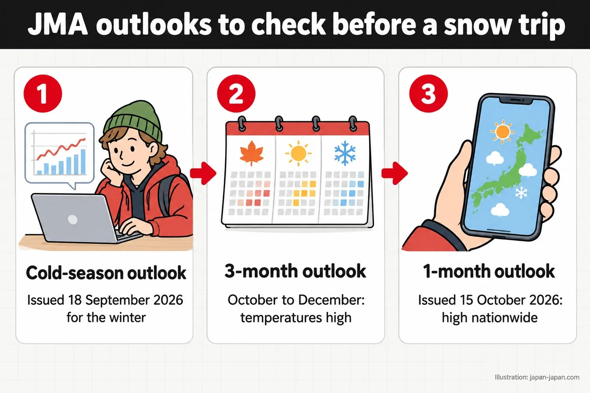
The steps above show the three JMA outlooks in the order they cover the season, from the whole winter down to the next month.
Best time to visit Japan for snow
In Tokyo, February has the most snow days, 3.5 on average. For snow on the ground most days, go to Hokkaido or the Sea of Japan side from December to February.
February holds about 41% of Tokyo’s 8.5 snow days a year, so a February trip gives the best odds of seeing flakes in the capital. In Kyoto, February also leads, with 2.2 days of 1 cm or more of new snow. In Sapporo, lasting snow cover usually runs from early December to early April, so any trip in that window will find snow.
Before a snow trip, check JMA’s outlooks in the order they update:
- Cold-season outlook: the whole winter, last issued on 18 September 2026.
- 3-month outlook: the next three months, now covering October to December.
- 1-month outlook: the next month, last issued on 15 October 2026.
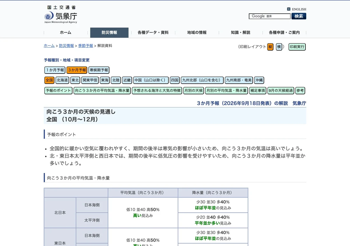
The screenshot above is JMA’s 3-month outlook page. Each outlook replaces the one before it, so open the newest version shortly before you book trains or tours around snow.
Dress for the numbers, not the postcards. In Sapporo, January averages a high of -0.4°C and a low of -6.4°C, with 76 cm of snow at its deepest. In Tokyo, January averages a high of 9.8°C and a low of 1.2°C. You need boots with grip in Sapporo and a warm coat in Tokyo. Our Japan winter packing list covers layers and footwear, and Japan temperature by month compares cities across the year.
FAQ
Does it snow in Tokyo every year?
On average Tokyo has 8.5 snow days a year by JMA’s count, but snow that settles is less common. Snow cover of 1 cm or more appeared in only 19 of the 30 winters from 1991 to 2020.
What month is best to see snow in Japan?
For Tokyo and Kyoto, February has the best odds. For deep snow, January and February in Hokkaido or on the Sea of Japan side are the safest choice. Sapporo gets 137 cm of snowfall in January and 116 cm in February on average.
Will Japan have a lot of snow in winter 2026-27?
JMA expects less snow than normal on the Sea of Japan side of eastern and western Japan, with a 50% chance of below normal. The chance of above-normal snowfall is still 20%. Last winter was also warm, yet the western Sea of Japan side got 135% of normal snowfall.
Does it snow in Kyoto in January?
Often, but only lightly. Kyoto averages 1.6 days with 1 cm or more of new snow in January, and the deepest snow averages 3 cm. The first day with snow on the ground is 12 January on average.
About the author



.jpg)

_Temple_area_hdsr_S5_11.jpg)

.jpg)
